
")

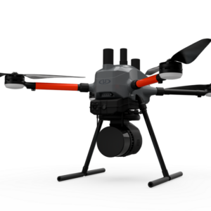
Inspired Flight IF800 Tomcat
Description

Inspired Flight IF800 Tomcat
NDAA Reliable & Adaptable Tool for Professionals
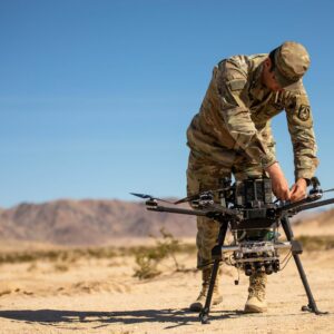
With an array of advanced features that cater to diverse professional applications, including high-resolution aerial photogrammetry, surveying, search and rescue, and infrastructure inspection, the IF800 Tomcat maximizes operational efficiency and productivity.
LiDAR
The Inspired Flight UAS platforms are known for their reliability, stability, and lack of vibration. These attributes allow LiDAR operators to have ultimate confidence that their sensitive payload will be well protected by the performance and safety features of the aircraft.
Used for a variety of surveying, construction, and infrastructure projects, UAS-based LiDAR allows for engineering-grade 3D models to be captured more efficiently. A UAS team equipped with a LiDAR system will be able to accomplish their objectives much quicker than a traditional land-based survey crew, and at a much lower cost than using traditional aircraft.
Photogrammetry
Used in a wide variety of industrial verticals, this form of mapping allows for highly accurate 2D, colorized maps using relatively inexpensive sensors. Inspired Flight’s photogrammetry solutions automatically write geotagged metadata directly to the image and camera SD card, allowing for a streamlined mapping workflow. The Inspired Flight UAS platforms are all enabled for an RTK/PPK module available as an add-on that enables centimeter level accuracies for mapping and surveying applications.
- Blue sUAS Certified
- NDAA Compliance
- Medium Lift 6.6lbs.
- 50+ Minute Flight Time
- Interchangeable Sensors
- Custom Care Plans


Reviews
There are no reviews yet