GeoCue TrueView 535 3DIS Sensor

Category:

(0 reviews)

Description

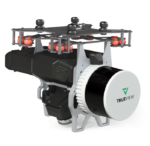
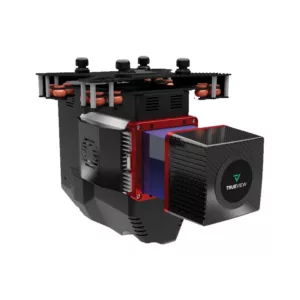
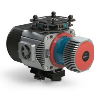
GeoCue TrueView 535 3DIS Sensor with Dual Drone and Optional Mobile Mapping Capability

The TrueView 535 builds upon the success of our best-selling TrueView 515. We’ve added a third LiDAR beam return to improve vegetation capture detail, a third nadir camera to improve photogrammetry deliverables, and a longer usable LiDAR range to increase flexibility.

Specification Value
Data Collection LiDAR + Imagery
Laser Scanner Hesai XT32M2X
LiDAR Range – Usable 120 m @ 20% reflectivity
LiDAR Beams/Returns 32/3
Cross-track Field of View (FOV)/Combined 120°
In-track FOV 40.3° (-20° to +19.5°)
Pulse Repetition Rate 640 kHz
Scanner Performance
  • Precision: 5 mm
  • Accuracy: 20 mm
GNSS/INS Performance
  • Position: 20-50 mm
  • Angle: 0.025 deg Roll/Pitch, 0.08 deg Heading
System Performance
  • Precision observed on one Strip: Typical 20 mm, Less than 15 mm (1 sigma) observed at 75 m on concrete
  • Accuracy: Typical 3 cm RMSE, better than 5 cm 3D RMSE – depending on GNSS conditions, accuracy of control points and coordinate system
Camera Sensor Triple 1’’ mechanical shutter, hardware mid-exposure pulse, 60 MP combined, RGB
System Operation Temperature Range -15° to 50° C
Mass 1.6 kg (payload unit only – no accessories including battery, mount, antenna, power adapter)
* 1 σ @ 50 m, nadir and with Strip Align

Reviews

There are no reviews yet

Add a review
You must be logged in to post a review Log In